Watercourse Surveys
WATERCOURSE SURVEYS
MT Surveys have carried out many watercourse surveys.
Watercourse surveys are carried out in order to provide engineers with data needed in order to better understand flooding issues, especially in and around areas of land for development.
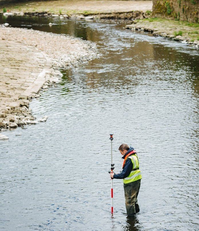
Surveyors measure cross sections of the water via either GPS on a pole or via traditional total station and prism methods. Surveyors will do this by wading across, or if too deep they will use a boat, in order to gain the measurements.
Although not requested often by clients, it is a specialism we host. We work safely to provide clients with data to meet their needs and specifications.
Watercourse surveys are carried out in order to provide engineers with data needed in order to better understand flooding issues, especially in and around areas of land for development.
Surveyors measure cross sections of the water via either GPS on a pole or via traditional total station and prism methods. Surveyors will do this by wading across, or if too deep they will use a boat, in order to gain the measurements.
Although not requested often by clients, it is a specialism we host. We work safely to provide clients with data to meet their needs and specifications.
You can view some of our other services below:
-
LASER SCANNING
-
TOPOGRAPHICAL SURVEYS
-
UTILITY MAPPING
-
MEASURED BUILDING SURVEYS
-
ENGINEERING SURVEYS